
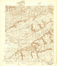
1934 Map of Harold
USGS Topo · Published 1934About this map
The Blackwater River and Yellow River define this Florida landscape, where early 20th-century life centered on river landings and the Louisville and Nashville Railroad. Small settlements like Harold and Floridale sit along the rail corridor, while deeper into the river basins, isolated homesteads such as Old Land Place and Old Whitmier Place are visible. The terrain is marked by numerous hammocks and bluffs, including Hickory Hammock and Riley Bluff, indicating areas of slightly higher ground amidst the surrounding wetlands.
Find a feature on this map
81 named features on this map. Tap any name to fly to it.
Don’t see what you’re looking for? This feature index may not catch every label — zoom into the map to look around manually.
Map Details
Editions of this 1934 Harold Map
3 editions found
Other maps of this area

1920 · Milton
USGS Topo · 1:62,500

1921 · Holley
USGS Topo · 1:62,500

1921 · Pensacola
USGS Topo · 1:62,500

1934 · Holt
USGS Topo · 1:48,000

1936 · Holley
USGS Topo · 1:48,000

1937 · Holt
USGS Topo · 1:62,500

1937 · Harold
USGS Topo · 1:62,500

1938 · Mary Esther
USGS Topo · 1:62,500

1938 · Holley
USGS Topo · 1:62,500

1938 · Harold
USGS Topo · 1:62,500