
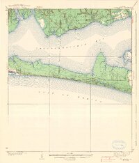
1938 Map of Villa Tasso
USGS Topo · Published 1938About this map
Choctawhatchee Bay dominates this coastal landscape, serving as the central waterway between the mainland and the narrow barrier peninsula along the Gulf of Mexico. In the northwest, the settlement of Valparaiso sits at the confluence of Boggy Bayou and Rocky Bayou, while smaller outposts like Postil and Villa Tasso occupy the northern shore. This 1930s survey captures a transition in land use, showing the eastern portion of the Moreno Point Military Reservation and the extensive acreage of the Choctawhatchee National Forest.
Find a feature on this map
41 named features on this map. Tap any name to fly to it.
Don’t see what you’re looking for? This feature index may not catch every label — zoom into the map to look around manually.
Map Details
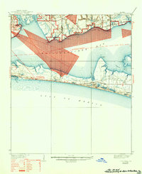
Editions of this 1938 Villa Tasso Map
4 editions found

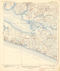
Other maps of this area

1934 · Holt
USGS Topo · 1:48,000

1934 · Niceville
USGS Topo · 1:48,000

1935 · Villa Tasso
USGS Topo · 1:48,000

1935 · De Funiak Springs
USGS Topo · 1:48,000

1936 · Niceville
USGS Topo · 1:62,500

1936 · Point Washington
USGS Topo · 1:48,000

1937 · Holt
USGS Topo · 1:62,500

1938 · Mary Esther
USGS Topo · 1:62,500

1938 · De Funiak Springs
USGS Topo · 1:62,500
1939 · Point Washington
USGS Topo · 1:62,500