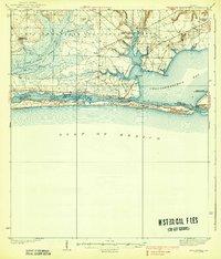
1938 Map of Mary Esther
USGS Topo · Published 1938About this map
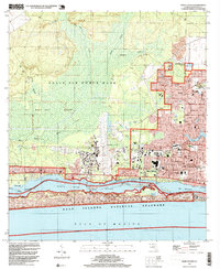
Choctawhatchee National Forest dominates the northern landscape of this coastal survey, where the early infrastructure of the Florida Panhandle's military and maritime heritage is clearly visible. The map records a pivotal era before the intensive modern development of the Emerald Coast, featuring the Valparaiso Landing Field and the Moreno Point Military Reservation. Along the intricate shoreline of Choctawhatchee Bay, the settlement of Fort Walton sits at the junction of the Santa Rosa Sound and the bay, while Destin guards the East Pass to the south.
Find a feature on this map
34 named features on this map. Tap any name to fly to it.
Don’t see what you’re looking for? This feature index may not catch every label — zoom into the map to look around manually.
Map Details
Editions of this 1938 Mary Esther Map
4 editions found

Historical Maps of Fort Walton Beach Through Time
9 maps found
1938 Mary Esther
Okaloosa County, FL
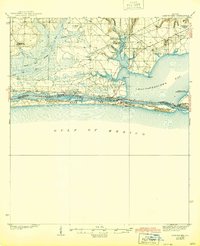
1970 Mary Esther
Okaloosa County, FL
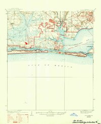
1994 Mary Esther
Okaloosa County, FL

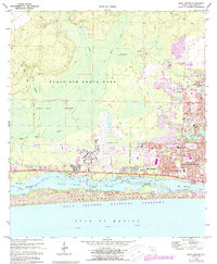
2012 Mary Esther
Okaloosa County, FL

2015 Mary Esther
Okaloosa County, FL

2018 Mary Esther
Okaloosa County, FL

2021 Mary Esther
Okaloosa County, FL

2024 Mary Esther
Okaloosa County, FL

2025 Mary Esther
Okaloosa County, FL