
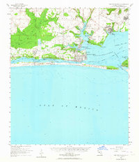
1956 Map of Fort Walton Beach
USGS Topo · Published 1958About this map
Fort Walton Beach and the surrounding emerald waters of the Florida Panhandle are captured here during a period of significant mid-century growth. The landscape is defined by the strategic military footprint of Eglin Air Force Base and Hurlburt Field, connected by the U. S. Government Railroad winding through the pine woods. Along the northern shores of Choctawhatchee Bay and the narrow Santa Rosa Sound, small communities like Mary Esther, Wright, and Shalimar appear in their earlier layouts. This survey details the intricate network of coastal waterways, including Garnier Bayou and Cinco Bayou, where maritime and military life merged. Of particular interest to local historians is the depiction of Destin near Moreno Point before the massive modern development of the coastline, showing the town's origins near the critical East Pass to the Gulf of Mexico.
Find a feature on this map
50 named features on this map. Tap any name to fly to it.
Don’t see what you’re looking for? This feature index may not catch every label — zoom into the map to look around manually.
Map Details
Editions of this 1956 Fort Walton Beach Map
2 editions found
Other maps of this area

1921 · Holley
USGS Topo · 1:62,500

1934 · Holt
USGS Topo · 1:48,000

1934 · Harold
USGS Topo · 1:62,500

1934 · Niceville
USGS Topo · 1:48,000

1935 · Villa Tasso
USGS Topo · 1:48,000

1936 · Niceville
USGS Topo · 1:62,500

1936 · Holley
USGS Topo · 1:48,000

1937 · Holt
USGS Topo · 1:62,500

1937 · Harold
USGS Topo · 1:62,500

1938 · Mary Esther
USGS Topo · 1:62,500