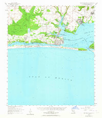
1956 Map of Fort Walton Beach
USGS Topo · Published 1964About this map
Eglin Air Force Base dominates this coastal landscape during the mid-1950s, illustrating the significant military footprint on Florida's panhandle. The map captures the rapid development of Fort Walton Beach and surrounding communities like Shalimar and Ocean City as they expanded around the bayous. To the west, Hurlburt Field and small settlements like Mary Esther and Florosa line the northern shore of the Santa Rosa Sound. A Government Railroad tracks inland toward Eglin Village, while the southern edge is defined by the long, narrow stretch of Santa Rosa Island. This survey provides a precise record of the shoreline before modern high-rise development, showing traditional landmarks such as the Oakland Heights Sch and the navigational aids at Lasater Point Light near the Intracoastal Waterway.
Find a feature on this map
43 named features on this map. Tap any name to fly to it.
Don’t see what you’re looking for? This feature index may not catch every label — zoom into the map to look around manually.
Map Details
Editions of this 1956 Fort Walton Beach Map
2 editions found

Other maps of this area

1921 · Holley
USGS Topo · 1:62,500

1934 · Holt
USGS Topo · 1:48,000

1934 · Harold
USGS Topo · 1:62,500

1934 · Niceville
USGS Topo · 1:48,000

1935 · Villa Tasso
USGS Topo · 1:48,000

1936 · Niceville
USGS Topo · 1:62,500

1936 · Holley
USGS Topo · 1:48,000

1937 · Holt
USGS Topo · 1:62,500

1937 · Harold
USGS Topo · 1:62,500

1938 · Mary Esther
USGS Topo · 1:62,500