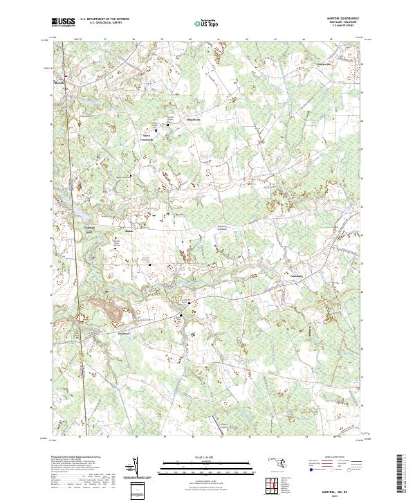
2023 Map of Marydel
USGS Topo · Published 2023About this map
Marydel straddles the boundary between Kent County, Delaware, and Caroline County, Maryland, serving as a focal point for this agrarian landscape. The map reveals an intricate network of drainage systems essential to the region's history, including the Tappahanna Ditch and Culbreth Marsh Ditch, which redirect water through the low-lying terrain. Small crossroads communities such as Chapeltown, Sandtown, and Petersburg define the settlement pattern, often centered around family landmarks and rural congregations. Genealogy researchers will find significant value in the numerous burial sites documented here, ranging from the Thomas Chapel Cem and Cow Marsh Baptist Church Cem to private family holdings like the Slaughter Family Plot Cem and Clements Family Plot Cem. To the south, the landscape shifts toward the Black Swamp and the headwaters of the Choptank River, while Hrupsa Airport provides a modern navigational reference point amidst the traditional farmsteads.
Find a feature on this map
108 named features on this map. Tap any name to fly to it.
Don’t see what you’re looking for? This feature index may not catch every label — zoom into the map to look around manually.
Map Details
Editions of this 2023 Marydel Map
This is the sole edition of this map. No revisions or reprints were ever made.
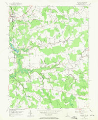
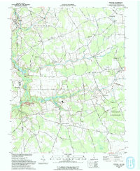
Historical Maps of Oak Point Acres Through Time
3 maps found