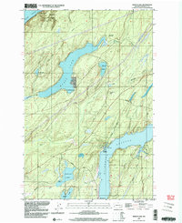
1997 Map of Mason Lake
USGS Topo · Published 2003About this map
Mason Lake dominates the central landscape of this Mason County region, serving as a primary focal point for the surrounding settlements of Little Hoquiam and Sherwood. To the north, the terrain meets the saltwater of the Hood Canal at Twanoh State Park and the small coastal community of Shady Beach. The map reveals a transition from these northern shorelines through a network of creeks like Sherwood Creek and Deer Creek toward the southern waters of Pickering Passage. On the eastern edge, the northern tip of Harstine Island is visible, featuring Jarrell Cove State Park and the settlement of Hartstene. Local infrastructure is anchored by the Grapeview Sch and several recreational points including Mason Lake County Park and Walkers Landing, illustrating a landscape shaped by both timber-era heritage and modern waterfront living.
Find a feature on this map
39 named features on this map. Tap any name to fly to it.
Don’t see what you’re looking for? This feature index may not catch every label — zoom into the map to look around manually.
Map Details
Editions of this 1997 Mason Lake Map
This is the sole edition of this map. No revisions or reprints were ever made.
Other maps of this area

1937 · Olympia
USGS Topo · 1:62,500

1938 · Allyn
USGS Topo · 1:62,500

1939 · Shelton
USGS Topo · 1:62,500

1943 · Potlatch
USGS Topo · 1:62,500

1949 · Olympia
USGS Topo · 1:62,500

1952 · Potlatch
USGS Topo · 1:62,500

1953 · Vaughn
USGS Topo · 1:24,000

1953 · Lake Wooten
USGS Topo · 1:24,000
1953 · Mason Lake
USGS Topo · 1:24,000
1953 · Belfair
USGS Topo · 1:24,000