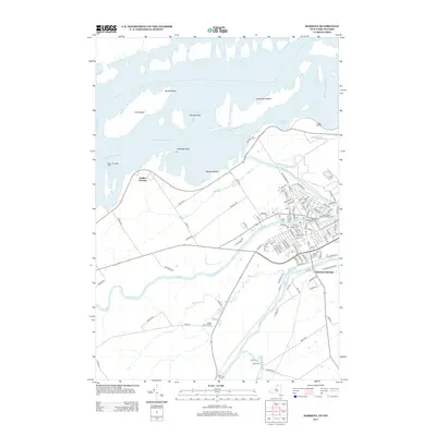
2013 Map of Massena
USGS Topo · Published 2013About this map
The Saint Lawrence River and its accompanying Saint Lawrence Seaway dominate the northern landscape, where massive features like the Long Sault Islands and Croil Island define the international boundary. This modern survey illustrates the intensive water management of the region, featuring the Massena-Power Canal alongside natural flows of the Grass River and Raquette River.
Find a feature on this map
114 named features on this map. Tap any name to fly to it.
Don’t see what you’re looking for? This feature index may not catch every label — zoom into the map to look around manually.
Map Details
Editions of this 2013 Massena Map
This is the sole edition of this map. No revisions or reprints were ever made.
Other maps of this area

1905 · Waddington
USGS Topo · 1:62,500

1906 · Massena
USGS Topo · 1:62,500

1907 · Massena
USGS Topo · 1:62,500

1942 · Chase Mills
USGS Topo · 1:24,000

1942 · Norfolk
USGS Topo · 1:24,000

1942 · Barnhart Island
USGS Topo · 1:24,000

1942 · Massena
USGS Topo · 1:24,000

1943 · Barnhart Island
USGS Topo · 1:31,680
1943 · Massena
USGS Topo · 1:31,680
1943 · Chase Mills
USGS Topo · 1:31,680