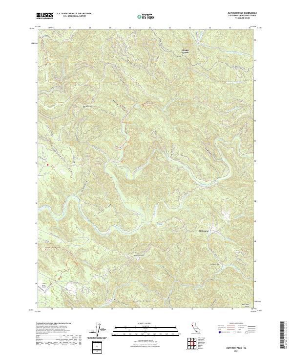
2021 Map of Mathison Peak
USGS Topo · Published 2021About this map
Mathison Peak serves as a central landmark in this portion of Mendocino County, where the landscape is defined by the steep, wooded drainage systems of the Big River, Little River, and Albion River. The map documents a rugged terrain carved by numerous gulches, including Russian Gulch and Manly Gulch, and heights such as Hi Chute Ridge. Small settlements and named locations like Melbourne, Tom Bell Flat, and Whiskey Springs are connected by a network of logging roads and trails, including Caspar Logging Rd and the Fort Bragg-Willits Rd. The inclusion of the Little River Airport near Albion Ridge highlights the modern infrastructure present in this otherwise heavily forested area. Researchers can trace the intricate network of recreation and resource trails like the Fern Canyon Trl Trl and Manly Gulch Trl Trl as they wind through the coastal canyon country.
Find a feature on this map
70 named features on this map. Tap any name to fly to it.
Don’t see what you’re looking for? This feature index may not catch every label — zoom into the map to look around manually.
Map Details
Editions of this 2021 Mathison Peak Map
This is the sole edition of this map. No revisions or reprints were ever made.
Other maps of this area

1920 · Glenblair
USGS Topo · 1:62,500

1920 · Fort Bragg
USGS Topo · 1:62,500

1943 · Glenblair
USGS Topo · 1:62,500

1943 · Fort Bragg
USGS Topo · 1:62,500

1943 · Albion
USGS Topo · 1:62,500

1943 · Navarro
USGS Topo · 1:62,500

1944 · Saddle Point
USGS Topo · 1:62,500

1957 · Ukiah
USGS Topo · 1:250,000

1960 · Ukiah
USGS Topo · 1:250,000
1960 · Elk
USGS Topo · 1:24,000