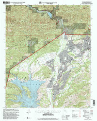
1995 Map of Matilija
USGS Topo · Published 2000About this map
Ventura County's interior unfolds across this landscape, where the northern waters of Lake Casitas meet the rising slopes of the Santa Ynez Mountains. The mid-1990s settlement pattern shows a distinct transition from the agricultural and suburban clusters of Ojai and Meiners Oaks into the protected wilderness of the Los Padres National Forest. Water management is central to this geography, as seen in the presence of the Matilija Dam and Matilija Lake along the Ventura River, alongside historical leisure spots like Matilija Hot Springs.
Find a feature on this map
62 named features on this map. Tap any name to fly to it.
Don’t see what you’re looking for? This feature index may not catch every label — zoom into the map to look around manually.
Map Details
Editions of this 1995 Matilija Map
This is the sole edition of this map. No revisions or reprints were ever made.
Other maps of this area

1903 · Santa Paula
USGS Topo · 1:62,500

1903 · Mt. Pinos
USGS Topo · 1:125,000

1904 · Ventura
USGS Topo · 1:62,500

1941 · Ventura
USGS Topo · 1:62,500

1942 · Santa Paula
USGS Topo · 1:62,500

1942 · Wheeler Springs
USGS Topo · 1:24,000

1943 · Old Man Mountain
USGS Topo · 1:24,000

1943 · Lion Canyon
USGS Topo · 1:24,000

1943 · Wheeler Springs
USGS Topo · 1:24,000
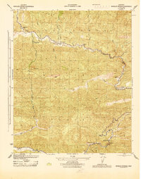
1944 · Wheeler Springs
USGS Topo · 1:31,680