
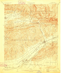
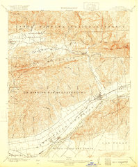
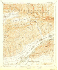
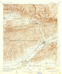
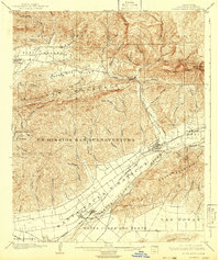
1903 Map of Santa Paula
USGS Topo · Published 1903About this map
The Ex Mission San Buenaventura boundary dominates the central hills of this 1903 survey, illustrating the transition from Spanish land grant eras to early twentieth-century American settlement. Along the fertile banks of the Santa Clara River, the Southern Pacific Railroad connects the bustling hub of Santa Paula with smaller agrarian outposts like Saticoy and Montalvo. The geography is defined by a series of north-south canyons, including Wheeler Canyon and Santa Paula Creek, which drain the northern highlands of the Pine Mountain and Zaca Lake Forest Reserve.
Find a feature on this map
65 named features on this map. Tap any name to fly to it.
Don’t see what you’re looking for? This feature index may not catch every label — zoom into the map to look around manually.
Map Details
Editions of this 1903 Santa Paula Map
6 editions found
Other maps of this area

1900 · Triunfo Pass
USGS Topo · 1:62,500

1900 · Piru
USGS Topo · 1:62,500

1903 · Mt. Pinos
USGS Topo · 1:125,000

1903 · Tejon
USGS Topo · 1:125,000

1903 · Camulos
USGS Topo · 1:125,000

1904 · Ventura
USGS Topo · 1:62,500

1904 · Hueneme
USGS Topo · 1:62,500

1921 · Piru
USGS Topo · 1:62,500

1921 · Triunfo Pass
USGS Topo · 1:62,500
1941 · Ventura
USGS Topo · 1:62,500