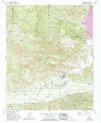
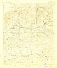
1921 Map of Piru
USGS Topo · Published 1921About this map
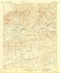
The Santa Clara River valley serves as the central artery for transportation and settlement in this 1921 edition, where the Southern Pacific railroad connects agricultural hubs like Fillmore and Piru. The landscape is defined by its dramatic relief, transitioning from the alluvial plains of Las Posas and Simi Valley into the high elevations of the Santa Barbara National Forest. Local economies are hinted at by specific locations such as Brownstone and Bardsdale, while the northern portion of the map is dominated by significant peaks like Hopper Mtn and San Cayetano Mtn. Water distribution is critical here, with an intricate network of drainage canyons including Sespe Creek and Happy Camp Canyon feeding into the main river systems that supported the region's early growth.
Find a feature on this map
64 named features on this map. Tap any name to fly to it.
Don’t see what you’re looking for? This feature index may not catch every label — zoom into the map to look around manually.
Map Details
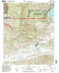
Editions of this 1921 Piru Map
4 editions found
Historical Maps of Thousand Oaks Through Time
9 maps found