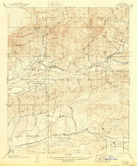
1921 Map of Piru
USGS Topo · Published 1944About this map
The Santa Clara River valley forms the central axis of this 1900 survey, anchoring a network of citrus-growing communities and early rail stops. The Southern Pacific railroad dictates the settlement pattern, connecting Fillmore, Piru, and the shipping point at Sespe Sta. through the rugged Ventura County landscape. South of the river, the planned agricultural community of Bardsdale sits on a level bench, while the southern margin captures the early layout of Moorpark and Somis at the edge of the Arroyo Simi. Significant canyon systems such as Happy Camp Canyon and Torrey Canyon cut through the high ridges, illustrating the topographic barriers that early ranchers and surveyors negotiated. This map captures the region after its initial rail-driven boom but before the significant suburban expansion of the mid-twentieth century.
Find a feature on this map
71 named features on this map. Tap any name to fly to it.
Don’t see what you’re looking for? This feature index may not catch every label — zoom into the map to look around manually.
Map Details
Editions of this 1921 Piru Map
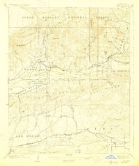
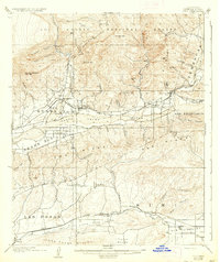
4 editions found
Other maps of this area

1900 · Triunfo Pass
USGS Topo · 1:62,500

1900 · Piru
USGS Topo · 1:62,500

1903 · Santa Paula
USGS Topo · 1:62,500

1903 · Calabasas
USGS Topo · 1:62,500

1903 · Mt. Pinos
USGS Topo · 1:125,000

1903 · Tejon
USGS Topo · 1:125,000

1903 · Camulos
USGS Topo · 1:125,000

1903 · Santa Susana
USGS Topo · 1:62,500

1904 · Hueneme
USGS Topo · 1:62,500

1921 · Piru
USGS Topo · 1:62,500