2024 Map of Matlacha
USGS Topo · Published 2024About this map
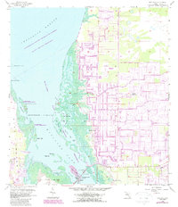
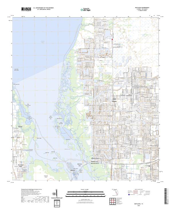
Bokeelia and the northern reaches of Pine Island define this coastal landscape, where the transition from dense residential grids to protected wetlands is clearly marked. To the east, the extensive suburban expansion of Cape Coral meets the waters of the Gator Slough Canal, while the central portion of the map is dominated by the Matlacha Pass National Wildlife Refuge. This protected area encompasses numerous mangrove keys and islands, including Big Smokehouse Key, Silver Key, and Indian Field. The map illustrates the specialized water-based infrastructure of the region, featuring the Florida Circumnavigational Paddling Trail and the Great Calusa Blueway Trail Phase II Trail. The settlement of Matlacha serves as a vital bridge between the mainland and Pine Island, surrounded by landmarks like Tom Black Lake and the Coral Ridge Cemetery.
Find a feature on this map
52 named features on this map. Tap any name to fly to it.
Don’t see what you’re looking for? This feature index may not catch every label — zoom into the map to look around manually.
Map Details
Editions of this 2024 Matlacha Map
This is the sole edition of this map. No revisions or reprints were ever made.