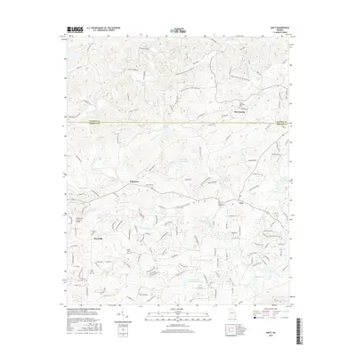
2017 Map of Matt
USGS Topo · Published 2017About this map
The Georgia Nuclear Aircraft Laboratory site occupies a significant portion of the northern terrain in this Forsyth and Dawson County region, marking a unique chapter of Cold War technological history. Downstream along Settingdown Creek, the landscape transitions into a network of small settlements and agricultural sites centered around Matt, Hightower, and Heardville. Water management is a defining characteristic of the area, evidenced by a series of numbered catchments including Reservoir Number One and Settingdown Cr Reservoir Number Two.
Find a feature on this map
144 named features on this map. Tap any name to fly to it.
Don’t see what you’re looking for? This feature index may not catch every label — zoom into the map to look around manually.
Map Details
Editions of this 2017 Matt Map
This is the sole edition of this map. No revisions or reprints were ever made.
Other maps of this area

1890 · Suwanee
USGS Topo · 1:125,000

1894 · Suwanee
USGS Topo · 1:125,000

1926 · Tate
USGS Topo · 1:62,500

1928 · Tate
USGS Topo · 1:62,500

1955 · Rome
USGS Topo · 1:250,000

1956 · Birmingham
USGS Topo · 1:24,000

1958 · Rome
USGS Topo · 1:250,000

1961 · Rome
USGS Topo · 1:250,000

1963 · Rome
USGS Topo · 1:250,000
1964 · Juno
USGS Topo · 1:24,000