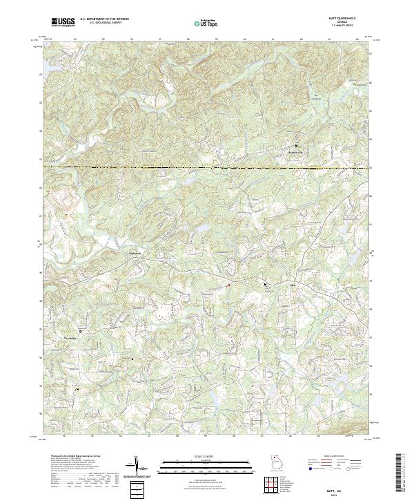
2024 Map of Matt
USGS Topo · Published 2024About this map
The Etowah River and its major tributaries, including Amicalola Creek, define the rolling landscape at the intersection of Dawson and Forsyth counties. This modern topographic survey illustrates a region where rural crossroads communities such as Matt, Barrettsville, and Hightower have evolved into residential nodes. For genealogists, the map identifies several key burial sites, including the Zion Hill Baptist Cem and Salem Methodist Cem, which mark the historical centers of local congregations. The drainage patterns of Settingdown Creek and Bannister Creek reveal the undulating terrain that shaped early land lots and road placement. Contemporary infrastructure like Dawson Forest Rd W and Kelly Bridge Rd follows the paths of older thoroughfares, connecting the northern reach of Big Savannah to the settlement at Heardville in the southwest.
Find a feature on this map
189 named features on this map. Tap any name to fly to it.
Don’t see what you’re looking for? This feature index may not catch every label — zoom into the map to look around manually.
Map Details
Editions of this 2024 Matt Map
This is the sole edition of this map. No revisions or reprints were ever made.
Other maps of this area

1890 · Suwanee
USGS Topo · 1:125,000

1894 · Suwanee
USGS Topo · 1:125,000

1926 · Tate
USGS Topo · 1:62,500

1928 · Tate
USGS Topo · 1:62,500

1955 · Rome
USGS Topo · 1:250,000

1956 · Birmingham
USGS Topo · 1:24,000

1958 · Rome
USGS Topo · 1:250,000

1961 · Rome
USGS Topo · 1:250,000

1963 · Rome
USGS Topo · 1:250,000
1964 · Juno
USGS Topo · 1:24,000