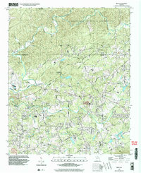
1999 Map of Matt
USGS Topo · Published 2003About this map
The Etowah River and Amicalola Creek converge in the northern reaches of this landscape, carving through the terrain where the Dawson Co and Forsyth Co line meets. In the final years of the twentieth century, this area maintained a mix of rural community centers and expanding conservation lands like the Dawson Forest State Wildlife Management Area. Local life centers on the settlements of Matt, Heardville, and Barrettsville, which are connected by a network of roads named for local families and landmarks, such as Brewton Road and Namon Wallace Road.
Find a feature on this map
47 named features on this map. Tap any name to fly to it.
Don’t see what you’re looking for? This feature index may not catch every label — zoom into the map to look around manually.
Map Details
Editions of this 1999 Matt Map
This is the sole edition of this map. No revisions or reprints were ever made.
Other maps of this area

1890 · Suwanee
USGS Topo · 1:125,000

1894 · Suwanee
USGS Topo · 1:125,000

1926 · Tate
USGS Topo · 1:62,500

1928 · Tate
USGS Topo · 1:62,500

1955 · Rome
USGS Topo · 1:250,000

1956 · Birmingham
USGS Topo · 1:24,000

1958 · Rome
USGS Topo · 1:250,000

1961 · Rome
USGS Topo · 1:250,000

1963 · Rome
USGS Topo · 1:250,000
1964 · Juno
USGS Topo · 1:24,000