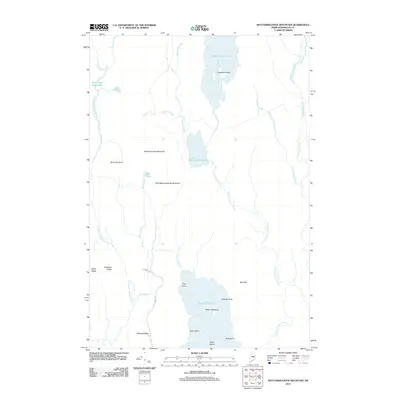
2011 Map of Mattamiscontis Mountain
USGS Topo · Published 2011About this map
Mattamiscontis Mountain and its smaller counterpart, Little Mattamiscontis Mountain, dominate the center of this Maine interior landscape. The region is defined by an extensive freshwater network, where Mattamiscontis Lake and the northern reaches of South Branch Lake provide significant aquatic coverage. Notable landforms such as Miller Ridge, Hazeltine Ridge, and Whitney Ridge suggest a terrain shaped by glacial activity, while the presence of Cranberry Island and Birch Island within the larger lakes points to established landmarks for navigators. Named water features like Sam Ayers Stream and Johnny Ayers Brook reflect the importance of small-scale hydrology in this part of Penobscot County. Transportation is minimal, limited to corridors such as E Branch Rd and Maine Rd, emphasizing the area's character as a managed timber or conservation territory at the start of the 2010s.
Find a feature on this map
32 named features on this map. Tap any name to fly to it.
Don’t see what you’re looking for? This feature index may not catch every label — zoom into the map to look around manually.
Map Details
Editions of this 2011 Mattamiscontis Mountain Map
This is the sole edition of this map. No revisions or reprints were ever made.
Other maps of this area

1942 · Lincoln
USGS Topo · 1:62,500

1947 · Schoodic
USGS Topo · 1:62,500

1949 · Schoodic
USGS Topo · 1:62,500

1951 · Norcross
USGS Topo · 1:62,500

1951 · Millinocket
USGS Topo · 1:62,500

1954 · Millinocket
USGS Topo · 1:250,000

1957 · Lincoln
USGS Topo · 1:62,500

1958 · Millinocket
USGS Topo · 1:250,000

1960 · Millinocket
USGS Topo · 1:250,000

1975 · Millinocket SW
USGS Topo · 1:24,000