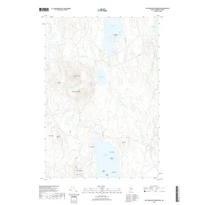
2018 Map of Mattamiscontis Mountain
USGS Topo · Published 2018About this map
Mattamiscontis Mtn and Little Mattamiscontis Mtn dominate this interior Maine landscape, where a series of prominent ridges and deep glacial lakes define the local geography. To the south, Whitney Ridge overlooks the Seboeis Cem, a vital point of reference for genealogists researching the plantation's history. The terrain is marked by a complex network of water bodies, including the expansive South Branch Lake with its numerous named points and islands like Black Cat Island and Dutch Island. The hydrography here is dense, with Mattamiscontis Stream and Sam Ayers Stream draining the highlands. Small mountain ponds like Tack Pond and Bear Pond are tucked between the peaks, while local access is maintained through a limited network of gravel ways such as Maine Rd and S Branch Camp Rd.
Find a feature on this map
37 named features on this map. Tap any name to fly to it.
Don’t see what you’re looking for? This feature index may not catch every label — zoom into the map to look around manually.
Map Details
Editions of this 2018 Mattamiscontis Mountain Map
This is the sole edition of this map. No revisions or reprints were ever made.
Other maps of this area

1942 · Lincoln
USGS Topo · 1:62,500

1947 · Schoodic
USGS Topo · 1:62,500

1949 · Schoodic
USGS Topo · 1:62,500

1951 · Norcross
USGS Topo · 1:62,500

1951 · Millinocket
USGS Topo · 1:62,500

1954 · Millinocket
USGS Topo · 1:250,000

1957 · Lincoln
USGS Topo · 1:62,500

1958 · Millinocket
USGS Topo · 1:250,000

1960 · Millinocket
USGS Topo · 1:250,000

1975 · Millinocket SW
USGS Topo · 1:24,000