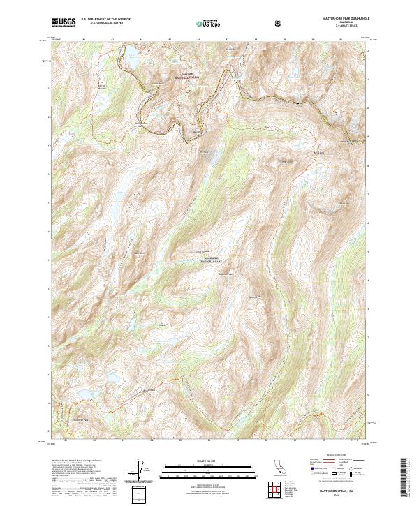
2021 Map of Matterhorn Peak
USGS Topo · Published 2021About this map
The Mono Co Tuolumne Co boundary bisects this high Sierra landscape, marking the transition from the Toiyabe National Forest in the north to Yosemite National Park in the south. The dramatic topography is defined by the Sawtooth Ridge, where Matterhorn Peak stands as the primary landmark near The Cleaver. This 2021 survey details a complex network of high-altitude water bodies including Peeler Lake, Crown Lake, and the remote Doe Lake, which feed the drainages of Matterhorn Cr and Piute Cr.
Find a feature on this map
58 named features on this map. Tap any name to fly to it.
Don’t see what you’re looking for? This feature index may not catch every label — zoom into the map to look around manually.
Map Details
Editions of this 2021 Matterhorn Peak Map
This is the sole edition of this map. No revisions or reprints were ever made.
Other maps of this area

1896 · Dardanelles
USGS Topo · 1:125,000

1897 · Yosemite
USGS Topo · 1:125,000

1898 · Dardanelles
USGS Topo · 1:125,000

1900 · Yosemite
USGS Topo · 1:125,000

1901 · Mt. Lyell
USGS Topo · 1:125,000

1903 · Yosemite
USGS Topo · 1:125,000

1909 · Yosemite
USGS Topo · 1:125,000

1909 · Bridgeport
USGS Topo · 1:125,000

1911 · Bridgeport
USGS Topo · 1:125,000

1920 · Bridgeport
USGS Topo · 1:125,000