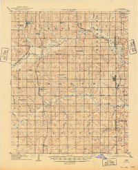
1908 Map of Maud
USGS Topo · Published 1949About this map
Maud sits at the eastern edge of this territory, where the Boundary Line separates Pottawatomie and Seminole counties. Surveyed in 1906–1907 just as Oklahoma transitioned to statehood, the landscape is defined by a dense network of early rural settlements and one-room schools. The Chicago Rock Island and Pacific RR and the Atchison Topeka and Santa Fe RR cut through the western townships, connecting small stops like Pearson and Romulus to the wider region. In the south, the community of Sacred Heart P O and Georgetown appear near the Avoca township line.
Find a feature on this map
57 named features on this map. Tap any name to fly to it.
Don’t see what you’re looking for? This feature index may not catch every label — zoom into the map to look around manually.
Map Details
Editions of this 1908 Maud Map
3 editions found
Other maps of this area

1896 · Seminole and Prague
USGS Topo · 1:125,000

1898 · Purcell
USGS Topo · 1:125,000

1898 · Pauls Valley
USGS Topo · 1:125,000

1901 · Stonewall
USGS Topo · 1:125,000

1902 · Pauls Valley
USGS Topo · 1:125,000

1907 · Maud
USGS Topo · 1:62,500

1908 · Maud
USGS Topo · 1:62,500

1909 · Shawnee
USGS Topo · 1:62,500

1910 · McComb
USGS Topo · 1:62,500

1930 · McLoud
USGS Topo · 1:62,500