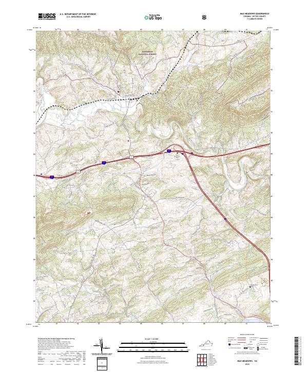
2022 Map of Max Meadows
USGS Topo · Published 2022About this map
Jacob McGavock Cem and the James McGavock Cem stand as significant genealogical markers in this Wythe County landscape, highlighting the long-standing family ties to the region. The terrain is defined by the prominent Lick Mountain and the winding course of Reed Creek, which draws together numerous smaller tributaries like McGavock Run and Beaverdam Cr. The northern reaches of the map include portions of the Jefferson National Forest, where the topography becomes increasingly complex.
Find a feature on this map
102 named features on this map. Tap any name to fly to it.
Don’t see what you’re looking for? This feature index may not catch every label — zoom into the map to look around manually.
Map Details
Editions of this 2022 Max Meadows Map
This is the sole edition of this map. No revisions or reprints were ever made.
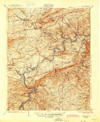
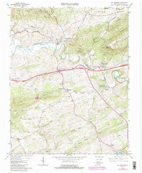
Historical Maps of Poletown Through Time
3 maps found