Loading...
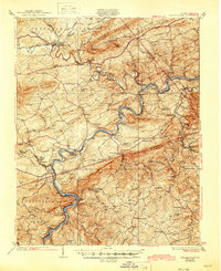
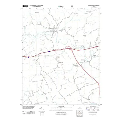
Loading map...1930 Map of Max Meadows
USGS Topo · Published 1945About this map
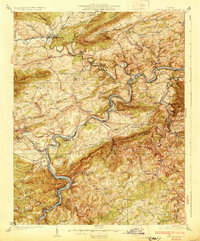
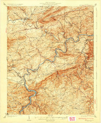
Reed Creek and the New River carve through a landscape of ridges and industrial history in this survey of Wythe and Carroll counties. The Norfolk and Western RR facilitates transport through the valley, connecting the established settlement at Max Meadows with a series of mills and industrial sites. Early iron and lead production is evident at Boom Furnace, Pierce Mill, and the riverside operations at Fosters Falls.
Find a feature on this map
126 named features on this map. Tap any name to fly to it.
Don’t see what you’re looking for? This feature index may not catch every label — zoom into the map to look around manually.
Map Details
Date Portrayed1930
Date Published1945
PublisherU.S. Geological Survey
Map TypeTopographic
Scale1:62,500
Physical Dimensions17 x 20.9 inches
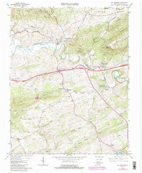
Editions of this 1930 Max Meadows Map
3 editions found
Historical Maps of Hillsville Through Time
7 maps found

Featured Locations
Source Details
SourceU.S. Geological Survey
CopyrightPublic Domain