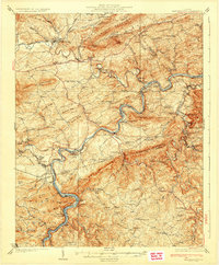
1930 Map of Max Meadows
USGS Topo · Published 1930About this map
Max Meadows and the surrounding industrial corridor of Southwest Virginia are defined by the winding course of the New River and the mineral-rich mountains of the late 1920s. This landscape reveals an economy built on iron and lead, anchored by sites like Boom Furnace and the established mining center at Austinville. The Norfolk and Western railway follows the river bends, connecting settlements such as Ivanhoe and Graham Forge to the wider region via the Lee Highway.
Find a feature on this map
134 named features on this map. Tap any name to fly to it.
Don’t see what you’re looking for? This feature index may not catch every label — zoom into the map to look around manually.
Map Details
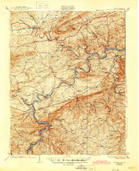
Editions of this 1930 Max Meadows Map
3 editions found

Other maps of this area

1887 · Pocahontas
USGS Topo · 1:125,000

1889 · Hillsville
USGS Topo · 1:125,000

1889 · Wytheville
USGS Topo · 1:125,000

1890 · Dublin
USGS Topo · 1:125,000

1891 · Pocahontas
USGS Topo · 1:125,000

1891 · Dublin
USGS Topo · 1:125,000

1892 · Hillsville
USGS Topo · 1:125,000

1892 · Wytheville
USGS Topo · 1:125,000

1894 · Pocahontas
USGS Topo · 1:125,000

1895 · Pocahontas
USGS Topo · 1:125,000