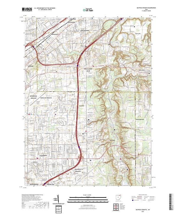
2023 Map of Mayfield Heights
USGS Topo · Published 2023About this map
The suburban development of the eastern Cleveland suburbs is detailed here at the juncture of Lake, Geauga, and Cuyahoga counties. The Chagrin River carves a deep valley through Willoughby Hills and Gates Mills, creating a sharp contrast between the dense residential grids of Lyndhurst and the more wooded, estate-style layouts of Waite Hill. Educational and spiritual centers occupy prominent tracts, including the Rabbinical College Telshe and Borromeo Seminary in Wickliffe. The landscape is also defined by its transportation corridors, with the I-271 and I-90 interchange serving as a major hub near the Cuyahoga County Airport. Significant cemeteries and memorial parks, such as Whitehaven Memorial Park and the Wickliffe Village Cemetery, provide important touchpoints for local genealogy and land-use history. In the southeast, smaller natural features like Deans Fall and Deans Gully mark the transition toward the more rural terrain of Chesterland.
Find a feature on this map
55 named features on this map. Tap any name to fly to it.
Don’t see what you’re looking for? This feature index may not catch every label — zoom into the map to look around manually.
Map Details
Editions of this 2023 Mayfield Heights Map
This is the sole edition of this map. No revisions or reprints were ever made.
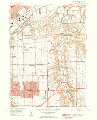
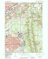
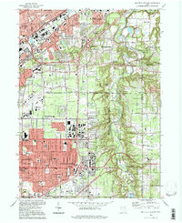
Historical Maps of Mayfield Heights Through Time
4 maps found