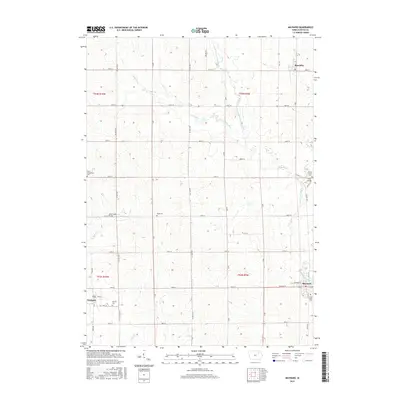
2015 Map of Maynard
USGS Topo · Published 2015About this map
Maynard sits at the convergence of local routes and river branches in this corner of Fayette County, where the landscape is defined by the winding paths of the Volga River and its tributaries. The settlement pattern here is anchored by small towns and rural community centers, with Westgate to the west and Randalia in the north. This 2015 U.S. Geological Survey representation documents a deeply established agrarian network, indicated by the numerous burial grounds that serve as silent witnesses to generations of local families. From Calvary Cem near Westgate to Union Evangelical Cem and Center Grove Cem, these sites are key for genealogical research. The geography is further detailed by landmarks such as the Stoe Creek Bridge and Twin Bridge, which mark essential crossings over the Stoe Cr and Little Volga River, respectively, highlighting how the waterway system dictated the local road infrastructure.
Find a feature on this map
81 named features on this map. Tap any name to fly to it.
Don’t see what you’re looking for? This feature index may not catch every label — zoom into the map to look around manually.
Map Details
Editions of this 2015 Maynard Map
This is the sole edition of this map. No revisions or reprints were ever made.
Other maps of this area

1901 · Oelwein
USGS Topo · 1:125,000

1954 · Waterloo
USGS Topo · 1:250,000

1955 · Waterloo
USGS Topo · 1:250,000

1959 · Dubuque
USGS Topo · 1:250,000

1961 · Dubuque
USGS Topo · 1:250,000

1962 · Dubuque
USGS Topo · 1:250,000

1971 · Sumner
USGS Topo · 1:24,000

1971 · Alpha
USGS Topo · 1:24,000

1971 · Fairbank
USGS Topo · 1:24,000

1976 · Dubuque
USGS Topo · 1:250,000