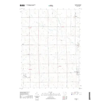
2018 Map of Maynard
USGS Topo · Published 2018About this map
Maynard and Westgate anchor this section of Fayette County, where the agricultural landscape is defined by the winding paths of the Volga River and its various tributaries. The terrain is notably dissected by the North Branch Volga River and the Little Volga River, which dictate the placement of local infrastructure like the Twin Bridge and the Stoe Creek Bridge. For genealogists and local historians, the map is a primary source for locating rural burials across several denominations and family plots, including Union Evangelical Cem, Hope Cem, and Calvary Cem. Small settlements like Randalia in the north maintain their footprint within a rigid grid of county roads such as Co Hwy W14 and Co Hwy W33, illustrating the persistent 19th-century township structure that continues to shape this corner of Iowa.
Find a feature on this map
50 named features on this map. Tap any name to fly to it.
Don’t see what you’re looking for? This feature index may not catch every label — zoom into the map to look around manually.
Map Details
Editions of this 2018 Maynard Map
This is the sole edition of this map. No revisions or reprints were ever made.
Other maps of this area

1901 · Oelwein
USGS Topo · 1:125,000

1954 · Waterloo
USGS Topo · 1:250,000

1955 · Waterloo
USGS Topo · 1:250,000

1959 · Dubuque
USGS Topo · 1:250,000

1961 · Dubuque
USGS Topo · 1:250,000

1962 · Dubuque
USGS Topo · 1:250,000

1971 · Sumner
USGS Topo · 1:24,000

1971 · Alpha
USGS Topo · 1:24,000

1971 · Fairbank
USGS Topo · 1:24,000

1976 · Dubuque
USGS Topo · 1:250,000