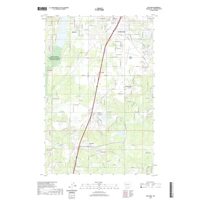
2020 Map of Maytown
USGS Topo · Published 2020About this map
Tumwater and its surrounding rural corridors are captured here during a period of sustained modern development south of the Washington state capital. The landscape is defined by a dense network of glacial lakes including Black Lake, Scott Lake, and Deep Lake, which serve as focal points for residential clusters like Belmore and South Union. The central corridor is dominated by the Olympia Regional Airport and the BNSF Railway, illustrating the intersection of regional transit and commerce. Significant conservation efforts are represented by the Billy Frank Jr Nisqually National Wildlife Refuge and the open spaces of Rocky Prairie. In the northern section, the Olympic Memorial Garden Cem sits near Bush Prairie, while the southern reaches center on the community of Maytown. This survey details the transition from established suburban centers to the agricultural and prairie lands that characterize the Thurston County interior.
Find a feature on this map
171 named features on this map. Tap any name to fly to it.
Don’t see what you’re looking for? This feature index may not catch every label — zoom into the map to look around manually.
Map Details
Editions of this 2020 Maytown Map
This is the sole edition of this map. No revisions or reprints were ever made.
Other maps of this area

1916 · Chehalis
USGS Topo · 1:125,000

1937 · Olympia
USGS Topo · 1:62,500

1939 · Shelton
USGS Topo · 1:62,500

1940 · Tenino
USGS Topo · 1:62,500

1941 · Gate
USGS Topo · 1:62,500

1944 · Tenino
USGS Topo · 1:62,500

1949 · Tenino
USGS Topo · 1:62,500

1949 · Olympia
USGS Topo · 1:62,500

1953 · Hoquiam
USGS Topo · 1:250,000

1953 · Rochester
USGS Topo · 1:62,500