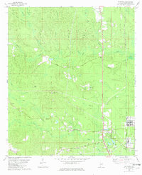
1982 Map of Mc Intosh
USGS Topo · Published 1982About this map
McIntosh serves as the focal point of this southwestern Alabama landscape, situated along the Southern railroad line and the St Stephens Meridian. The area is characterized by a network of drainage systems including Bilbo Creek, Lewis Creek, and Birch Branch, interspersed with small rural settlements like Toinette and Hawthorn. Local infrastructure is tied to both the land and the rail, as seen with the McIntosh Sta and several industrial Claypit sites.
Find a feature on this map
47 named features on this map. Tap any name to fly to it.
Don’t see what you’re looking for? This feature index may not catch every label — zoom into the map to look around manually.
Map Details
Editions of this 1982 Mc Intosh Map
This is the sole edition of this map. No revisions or reprints were ever made.
Other maps of this area

1943 · Choctaw Bluff
USGS Topo · 1:62,500

1943 · Tensaw
USGS Topo · 1:62,500

1943 · Citronelle
USGS Topo · 1:62,500

1943 · McIntosh
USGS Topo · 1:62,500

1944 · McIntosh
USGS Topo · 1:62,500

1944 · Tensaw
USGS Topo · 1:62,500

1946 · Citronelle
USGS Topo · 1:62,500

1946 · Choctaw Bluff
USGS Topo · 1:62,500

1953 · Andalusia
USGS Topo · 1:250,000

1953 · Hattiesburg
USGS Topo · 1:250,000