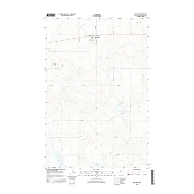
2014 Map of McClusky
USGS Topo · Published 2014About this map
McClusky serves as the primary hub in this portion of Sheridan County, centered around a traditional grid system of streets like Main St E and Avenue A. The landscape is characterized by its numerous glacial depressions and wetlands, including Johns Lake and Pop Lake to the south. A significant piece of regional infrastructure, the McClusky Canal, cuts through the western edge of the area, illustrating the engineering efforts to manage water across the North Dakota plains. The Mc Clusky Municipal Airport is located just west of the town center, providing an essential link for this agricultural community. For those studying the layout of modern Sheridan County, the map provides a clear look at the intersection of local routes such as Cr-4211 with the established township and range road network.
Find a feature on this map
26 named features on this map. Tap any name to fly to it.
Don’t see what you’re looking for? This feature index may not catch every label — zoom into the map to look around manually.
Map Details
Editions of this 2014 McClusky Map
This is the sole edition of this map. No revisions or reprints were ever made.
Other maps of this area

1945 · Pelican Lake
USGS Topo · 1:62,500

1947 · Pelican Lake
USGS Topo · 1:62,500

1947 · Lincoln Valley
USGS Topo · 1:62,500

1954 · McClusky
USGS Topo · 1:250,000

1958 · McClusky
USGS Topo · 1:250,000

1959 · Pickardville
USGS Topo · 1:24,000

1959 · Mercer SE
USGS Topo · 1:24,000

1959 · McClusky
USGS Topo · 1:24,000

1960 · Lincoln Valley SE
USGS Topo · 1:24,000

1960 · Horse Lake
USGS Topo · 1:24,000