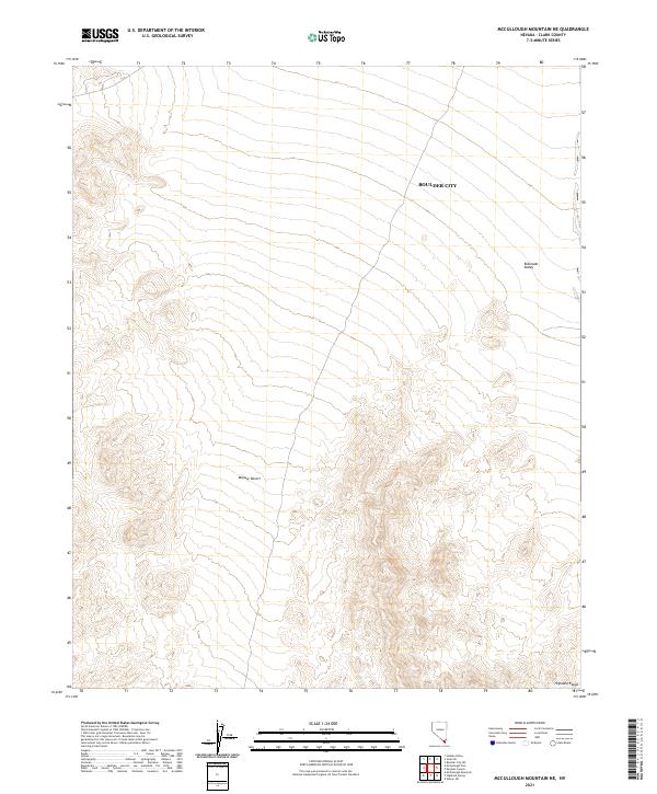
2021 Map of McCullough Mountain NE
USGS Topo · Published 2021About this map
Boulder City boundaries extend into this desert landscape, where the flat expanse of the Eldorado Valley meets the rising terrain of the Highland Range. This 2021 survey documents the transition between the arid basin and the surrounding mountain slopes, illustrating the township and range divisions that structure the land use in this part of Clark County. The map provides a clear look at the vast Mojave Desert terrain, highlighting the geographic isolation and the precise municipal limits as they reach toward the southern Nevada wilderness. For those studying the recent growth of the region, it shows how modern boundaries are imposed upon the ancient, dry lake beds and rocky ridges of the Mojave.
Find a feature on this map
10 named features on this map. Tap any name to fly to it.
Don’t see what you’re looking for? This feature index may not catch every label — zoom into the map to look around manually.
Map Details
Editions of this 2021 McCullough Mountain NE Map
This is the sole edition of this map. No revisions or reprints were ever made.
Other maps of this area

1886 · Camp Mohave
USGS Topo · 1:250,000

1892 · Camp Mohave
USGS Topo · 1:250,000

1910 · Ivanpah
USGS Topo · 1:250,000

1912 · Ivanpah
USGS Topo · 1:250,000

1926 · Nelson
USGS Topo · 1:96,000

1942 · Camp Mohave
USGS Topo · 1:250,000

1942 · Ivanpah
USGS Topo · 1:250,000

1947 · Kingman
USGS Topo · 1:250,000

1948 · Kingman
USGS Topo · 1:250,000

1954 · Kingman
USGS Topo · 1:250,000