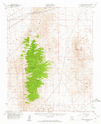
1960 Map of McCullough Mtn
USGS Topo · Published 1961About this map
The McCullough Range dominates this 1960 survey of southern Nevada, with its high point at McCullough Mtn providing a vertical anchor between the broad Eldorado Valley and Piute Valley. Water sources are the defining features of this arid landscape, traced through numerous named outlets such as McClanahan Spring, Ora Hanna Spring, and Railroad Spring. These points would have been vital for cattle operations, evidenced by Cow Camp and Cow Spring in the southern reaches.
Find a feature on this map
26 named features on this map. Tap any name to fly to it.
Don’t see what you’re looking for? This feature index may not catch every label — zoom into the map to look around manually.
Map Details
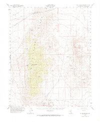
Editions of this 1960 McCullough Mtn Map
2 editions found
Other maps of this area

1886 · Camp Mohave
USGS Topo · 1:250,000

1892 · Camp Mohave
USGS Topo · 1:250,000

1910 · Ivanpah
USGS Topo · 1:250,000

1912 · Ivanpah
USGS Topo · 1:250,000

1926 · Nelson
USGS Topo · 1:96,000

1926 · Mohave City
USGS Topo · 1:96,000

1942 · Camp Mohave
USGS Topo · 1:250,000

1942 · Ivanpah
USGS Topo · 1:250,000

1947 · Kingman
USGS Topo · 1:250,000

1948 · Kingman
USGS Topo · 1:250,000