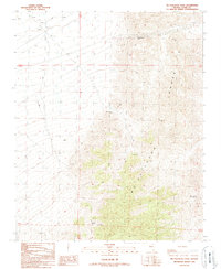
1989 Map of McCullough Pass
USGS Topo · Published 1990About this map
McCullough Range dominates this portion of Clark County, Nevada, providing a sharp topographical contrast between the high peaks and the lower-lying basins to the west. This 1989 provisional survey reveals a landscape defined by scarce water sources and resource extraction, with named locations like McClanahan Spring, McCullough Spring, and general Springs marking critical points in the arid terrain. The map identifies McCullough Pass as a key natural corridor through the mountains, while signs of industrial and exploratory activity are evident in the numerous Sandpits, a Borrow Pit, and a location marked for Borax. A single Corral and scattered Prospect markings suggest the sparse human footprint of ranching and mining that persisted in this high desert region into the late twentieth century.
Find a feature on this map
16 named features on this map. Tap any name to fly to it.
Don’t see what you’re looking for? This feature index may not catch every label — zoom into the map to look around manually.
Map Details
Editions of this 1989 McCullough Pass Map
This is the sole edition of this map. No revisions or reprints were ever made.
Other maps of this area

1910 · Ivanpah
USGS Topo · 1:250,000

1912 · Ivanpah
USGS Topo · 1:250,000

1942 · Ivanpah
USGS Topo · 1:250,000

1947 · Kingman
USGS Topo · 1:250,000

1948 · Kingman
USGS Topo · 1:250,000

1954 · Kingman
USGS Topo · 1:250,000

1955 · Kingman
USGS Topo · 1:250,000

1955 · Roach Lake
USGS Topo · 1:62,500

1958 · Kingman
USGS Topo · 1:250,000

1960 · Kingman
USGS Topo · 1:250,000