2022 Map of McDonald
USGS Topo · Published 2022About this map
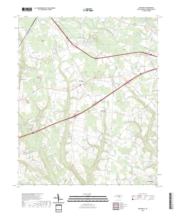
The lowlands of Robeson County are defined by an extensive network of blackwater drainage, where the Lumber River and its numerous tributaries shape the rural landscape. This modern survey illustrates how agricultural land is carved from the surrounding wetlands, with the settlements of McDonald and Raynham situated amidst a complex of drainage features like Back Swamp, Aaron Swamp, and Ashpole Swamp. The map provides a detailed view of the regional road network, where historic routes like Union School Rd and Henry Berry Rd intersect with modern thoroughfares.
Find a feature on this map
86 named features on this map. Tap any name to fly to it.
Don’t see what you’re looking for? This feature index may not catch every label — zoom into the map to look around manually.
Map Details
Editions of this 2022 McDonald Map
This is the sole edition of this map. No revisions or reprints were ever made.
Historical Maps of Fairmont Through Time
1 maps found