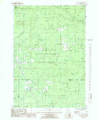
1985 Map of McFarland
USGS Topo · Published 1985About this map
The Escanaba River State Forest dominates this mid-1980s survey, representing a landscape defined by its waterways and timber management in the Upper Peninsula. Small settlements like McFarland and Ewing appear as quiet outposts along the transportation corridors that cut through the heavy forest cover. The drainage patterns of the Rapid River and Deer Creek illustrate the complex hydrology of the region, where numerous small tributaries like Deadhorse Creek and features such as Boiling Spring break the woodland expanse.
Find a feature on this map
7 named features on this map. Tap any name to fly to it.
Don’t see what you’re looking for? This feature index may not catch every label — zoom into the map to look around manually.
Map Details
Editions of this 1985 McFarland Map
This is the sole edition of this map. No revisions or reprints were ever made.
Other maps of this area

1932 · Skandia SW
USGS Topo · 1:31,680

1932 · Rock SW
USGS Topo · 1:31,680

1932 · Helena NE
USGS Topo · 1:31,680

1932 · Rock NE
USGS Topo · 1:31,680

1932 · Skandia SE
USGS Topo · 1:31,680

1932 · Rock SE
USGS Topo · 1:31,680

1932 · Harvey SE
USGS Topo · 1:31,680

1932 · Rock NW
USGS Topo · 1:31,680

1932 · Helena
USGS Topo · 1:31,680

1951 · Helena
USGS Topo · 1:31,680