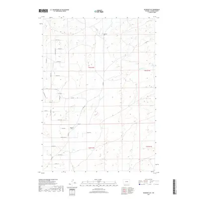
2017 Map of McKenzie Flat
USGS Topo · Published 2017About this map
McKenzie Flat and the surrounding high plains of Natrona County are defined by a network of residential roads with names evoking the Western frontier. Street names such as Branding Iron Blvd, Buckaroo Blvd, and Lonesome Cowboy Dr suggest a modern settlement pattern built upon the cultural identity of the ranching era. This development is situated in a landscape where water is the primary geographic anchor, as seen with Sand Springs and Mud Spring. The terrain is shaped by the intermittent flow of Sand Spring Cr and the topographical depression of McKenzie Draw. The grid of the Public Land Survey System, including townships like t36n r78w, provides a rigid framework for these newer thoroughfares, including Cowboy Way and Sundance Dr, as they reach out into the Wyoming sagebrush and shortgrass prairie.
Find a feature on this map
33 named features on this map. Tap any name to fly to it.
Don’t see what you’re looking for? This feature index may not catch every label — zoom into the map to look around manually.
Map Details
Editions of this 2017 McKenzie Flat Map
This is the sole edition of this map. No revisions or reprints were ever made.
Other maps of this area
1949 · Campbell Hill
USGS Topo · 1:24,000
1949 · Pratts Soda Lakes
USGS Topo · 1:24,000
1950 · Campbell Hill
USGS Topo · 1:24,000
1950 · Pratts Soda Lakes
USGS Topo · 1:24,000
1951 · The Reefs
USGS Topo · 1:24,000

1955 · Arminto
USGS Topo · 1:250,000

1955 · Casper
USGS Topo · 1:250,000

1958 · Casper
USGS Topo · 1:250,000

1958 · Arminto
USGS Topo · 1:250,000
1959 · Ormsby Draw
USGS Topo · 1:62,500