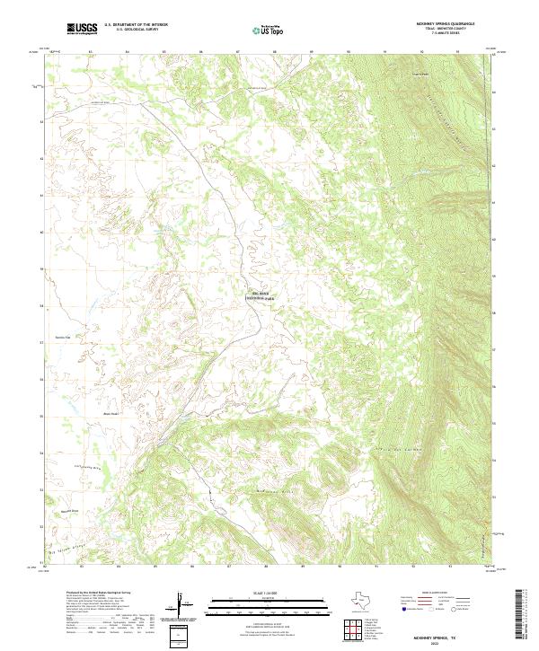
2022 Map of McKinney Springs
USGS Topo · Published 2022About this map
Big Bend National Park encompasses this high-desert landscape in Brewster County, defined by its scattered water sources and imposing geological formations. Remote water points such as Muskhog Spring and McKinney Spring have historically provided critical stops in this arid environment, while drainage systems like Javalina Cr and Tornillo Cr carve through the basin floors. The terrain is dominated by the massive limestone presence of Sierra del Caballo Muerto and the Sierra del Carmen, punctuated by prominent landmarks such as Stuarts Peak and the Black Peaks. The transition from the alluvial fans of Tornillo Flat to the elevated McKinney Hills illustrates the complex topography of the Chihuahuan Desert. Only sparse infrastructure exists here, primarily represented by the remote Dagger Flat Road providing access to the interior.
Find a feature on this map
17 named features on this map. Tap any name to fly to it.
Don’t see what you’re looking for? This feature index may not catch every label — zoom into the map to look around manually.
Map Details
Editions of this 2022 McKinney Springs Map
This is the sole edition of this map. No revisions or reprints were ever made.
Other maps of this area

1903 · Chisos Mountains
USGS Topo · 1:125,000

1905 · Chisos Mountains
USGS Topo · 1:125,000

1917 · Bone Spring
USGS Topo · 1:62,500

1918 · Bone Spring
USGS Topo · 1:125,000

1918 · Bone Spring
USGS Topo · 1:62,500

1919 · Maravillas Canyon
USGS Topo · 1:62,500

1920 · Bone Spring
USGS Topo · 1:62,500

1930 · Stillwell Creek
USGS Topo · 1:62,500

1959 · Emory Peak
USGS Topo · 1:250,000

1965 · Emory Peak
USGS Topo · 1:250,000