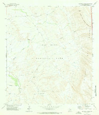
1971 Map of McKinney Springs
USGS Topo · Published 1973About this map
Big Bend National Park defines this arid landscape in Brewster County, where 1970s cartography highlights the crucial role of water sources in the high desert. The map details a network of vital hydrologic features including McKinney Springs, Muskhog Spring, and the ephemeral Tornillo Creek. These water points were essential for early transit and survival, linked by historic routes such as the Old Ore Road and the Telephone Trail.
Find a feature on this map
24 named features on this map. Tap any name to fly to it.
Don’t see what you’re looking for? This feature index may not catch every label — zoom into the map to look around manually.
Map Details
Editions of this 1971 McKinney Springs Map
This is the sole edition of this map. No revisions or reprints were ever made.
Other maps of this area

1903 · Chisos Mountains
USGS Topo · 1:125,000

1905 · Chisos Mountains
USGS Topo · 1:125,000

1917 · Bone Spring
USGS Topo · 1:62,500

1918 · Bone Spring
USGS Topo · 1:125,000

1918 · Bone Spring
USGS Topo · 1:62,500

1919 · Maravillas Canyon
USGS Topo · 1:62,500

1920 · Bone Spring
USGS Topo · 1:62,500

1930 · Stillwell Creek
USGS Topo · 1:62,500

1959 · Emory Peak
USGS Topo · 1:250,000

1965 · Emory Peak
USGS Topo · 1:250,000