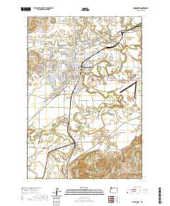
2020 Map of McMinnville
USGS Topo · Published 2020About this map
The Yamhill County Courthouse stands as the central landmark of McMinnville, a region where the urban grid meets the agricultural heart of the Willamette Valley. This landscape is defined by the confluence of the North Yamhill River and South Yamhill River, which carve winding paths through the surrounding lowlands. The presence of Linfield College and its Adult Degree Program signifies the area's long-standing role as an educational and cultural hub.
Find a feature on this map
167 named features on this map. Tap any name to fly to it.
Don’t see what you’re looking for? This feature index may not catch every label — zoom into the map to look around manually.
Map Details
Editions of this 2020 McMinnville Map
This is the sole edition of this map. No revisions or reprints were ever made.
Other maps of this area

1924 · Mc Minnville
USGS Topo · 1:48,000

1926 · Mc Minnville
USGS Topo · 1:62,500

1940 · McMinnville
USGS Topo · 1:62,500

1941 · Yamhill
USGS Topo · 1:62,500

1942 · Sheridan
USGS Topo · 1:62,500

1942 · Yamhill
USGS Topo · 1:62,500

1942 · Fairdale
USGS Topo · 1:62,500

1948 · Vancouver
USGS Topo · 1:250,000

1950 · Vancouver
USGS Topo · 1:250,000

1950 · Vancouver
USGS Topo · 1:250,000