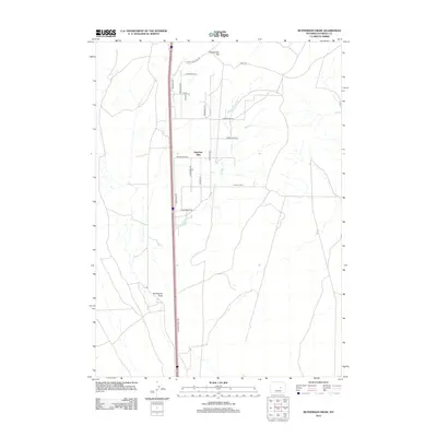
2012 Map of McPherson Draw
USGS Topo · Published 2012About this map
Antelope Hills dominates the central portion of this Natrona County landscape, a region defined by high desert terrain and seasonal drainage patterns. The modern transportation corridor is anchored by Interstate 25 and its parallel Frontage Rd, which follow a historical path north through the hills. To the south and west, the ephemeral waters of McPherson Draw carve through the land, while the northern horizon rises toward Twentymile Hill. The map reveals a contemporary rural settlement pattern of residential drives and access roads with names like Buffalo Run, Longhorn Dr, and Trail Ridge Dr. This network of local roads branching off from the Old Salt Creek Hwy suggests a transition from traditional ranching toward modern land divisions, all while maintaining the sprawling character of the Wyoming plains.
Find a feature on this map
21 named features on this map. Tap any name to fly to it.
Don’t see what you’re looking for? This feature index may not catch every label — zoom into the map to look around manually.
Map Details
Editions of this 2012 McPherson Draw Map
This is the sole edition of this map. No revisions or reprints were ever made.
Other maps of this area

1949 · Pratts Soda Lakes
USGS Topo · 1:24,000

1950 · Pratts Soda Lakes
USGS Topo · 1:24,000

1951 · The Reefs
USGS Topo · 1:24,000

1952 · Bishop
USGS Topo · 1:24,000

1955 · Arminto
USGS Topo · 1:250,000

1955 · Casper
USGS Topo · 1:250,000

1958 · Casper
USGS Topo · 1:250,000

1958 · Arminto
USGS Topo · 1:250,000

1959 · Ormsby Draw
USGS Topo · 1:62,500
1960 · Bishop
USGS Topo · 1:24,000