
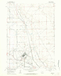
2015 Map of McPherson Draw
USGS Topo · Published 2015About this map
Antelope Hills and the surrounding high plains of Natrona County are defined by a network of residential and access roads etched into the Wyoming landscape. This mid-2010s survey shows a unique nomenclature system where streets are named for Western and pioneer imagery, including Sitting Bull St, Crazy Horse Rd, and Buckaroo Blvd. The terrain is characterized by dramatic elevation shifts at Twentymile Hill and the drainage of McPherson Draw. A distinct grid pattern emerges in the northern and eastern sections of the quadrangle, where thoroughfares such as Tumbleweed Dr and Cowhide Way suggest modern rural development amidst traditional ranching country. The presence of Trail Ridge Dr and Frontage Rd running north-south indicates a primary transit corridor that anchors these remote settlements.
Find a feature on this map
45 named features on this map. Tap any name to fly to it.
Don’t see what you’re looking for? This feature index may not catch every label — zoom into the map to look around manually.
Map Details
Editions of this 2015 McPherson Draw Map
This is the sole edition of this map. No revisions or reprints were ever made.
Other maps of this area

1949 · Pratts Soda Lakes
USGS Topo · 1:24,000

1950 · Pratts Soda Lakes
USGS Topo · 1:24,000

1951 · The Reefs
USGS Topo · 1:24,000

1952 · Bishop
USGS Topo · 1:24,000

1955 · Arminto
USGS Topo · 1:250,000

1955 · Casper
USGS Topo · 1:250,000

1958 · Casper
USGS Topo · 1:250,000

1958 · Arminto
USGS Topo · 1:250,000

1959 · Ormsby Draw
USGS Topo · 1:62,500
1960 · Bishop
USGS Topo · 1:24,000