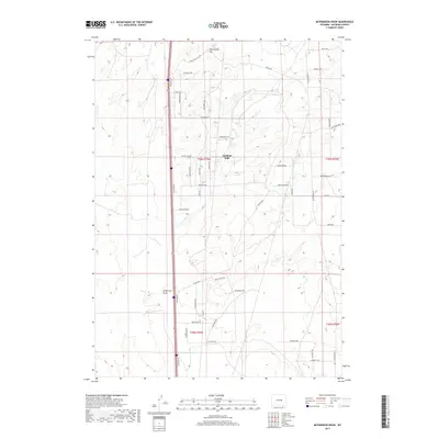
2017 Map of McPherson Draw
USGS Topo · Published 2017About this map
Antelope Hills and the winding course of McPherson Draw define this high plains landscape in Natrona County. The terrain is a network of named ridges and drainage patterns, anchored by Twentymile Hill to the north. A dense grid of rural residential roads, many bearing Western-inspired names like Bunkhouse Blvd, Winchester Way, and Buffalo Run, suggests a modern pattern of subdivided ranch land or rural development north of Casper.
Find a feature on this map
43 named features on this map. Tap any name to fly to it.
Don’t see what you’re looking for? This feature index may not catch every label — zoom into the map to look around manually.
Map Details
Editions of this 2017 McPherson Draw Map
This is the sole edition of this map. No revisions or reprints were ever made.
Other maps of this area

1949 · Pratts Soda Lakes
USGS Topo · 1:24,000

1950 · Pratts Soda Lakes
USGS Topo · 1:24,000

1951 · The Reefs
USGS Topo · 1:24,000

1952 · Bishop
USGS Topo · 1:24,000

1955 · Arminto
USGS Topo · 1:250,000

1955 · Casper
USGS Topo · 1:250,000

1958 · Casper
USGS Topo · 1:250,000

1958 · Arminto
USGS Topo · 1:250,000

1959 · Ormsby Draw
USGS Topo · 1:62,500
1960 · Bishop
USGS Topo · 1:24,000