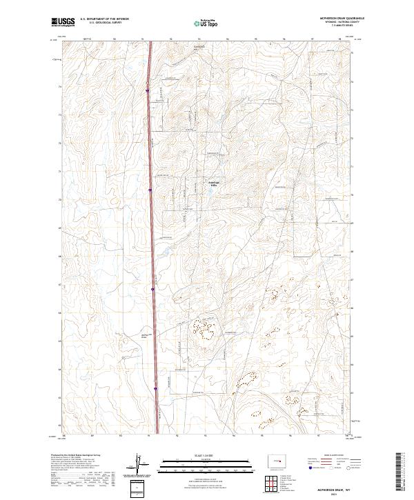
2021 Map of McPherson Draw
USGS Topo · Published 2021About this map
Antelope Hills and the prominent rising of Twentymile Hill define the high plains landscape of this Natrona County region. The terrain is deeply inscribed by the intermittent watercourse of McPherson Draw, which winds through a network of rural routes and specialized local roads. The presence of modern thoroughfares like Frontage Rd running parallel to the interstate indicates the contemporary connectivity of this ranchland area. Local nomenclature reflects a strong western character, with roads such as Sitting Bull, Crazy Horse Rd, and Buffalo Run carving paths through the open range. For researchers, the map provides a clear record of land divisions and secondary road development near the northern reaches of the county, illustrating the intersection of natural drainage basins and modern residential or agricultural infrastructure.
Find a feature on this map
43 named features on this map. Tap any name to fly to it.
Don’t see what you’re looking for? This feature index may not catch every label — zoom into the map to look around manually.
Map Details
Editions of this 2021 McPherson Draw Map
This is the sole edition of this map. No revisions or reprints were ever made.
Other maps of this area

1949 · Pratts Soda Lakes
USGS Topo · 1:24,000

1950 · Pratts Soda Lakes
USGS Topo · 1:24,000

1951 · The Reefs
USGS Topo · 1:24,000

1952 · Bishop
USGS Topo · 1:24,000

1955 · Arminto
USGS Topo · 1:250,000

1955 · Casper
USGS Topo · 1:250,000

1958 · Casper
USGS Topo · 1:250,000

1958 · Arminto
USGS Topo · 1:250,000

1959 · Ormsby Draw
USGS Topo · 1:62,500
1960 · Bishop
USGS Topo · 1:24,000