2024 Map of Meacham
USGS Topo · Published 2024About this map
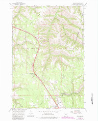
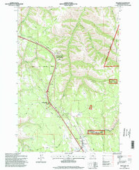
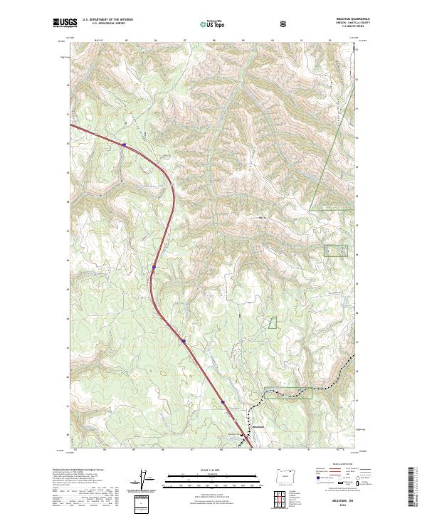
The settlement of Meacham serves as a focal point in this portion of the Blue Mountains, situated at the confluence of Meacham Creek and Beaver Creek. This modern survey illustrates the persistent importance of transportation corridors in the region, dominated by the winding path of Old Oregon Trl as it climbs through the high country. Much of the eastern and northern terrain is managed as part of the Umatilla National Forest, where the landscape is defined by a series of prominent divides including Telephone Ridge, Light Ridge, and Gibbon Ridge. Genealogy researchers will find the Meacham Cem located just south of the main townsite near College St. The map also captures the complex hydrology of the area, with numerous seasonal and perennial flows like Isquulktpe Creek and Little Isquulktpe Creek carving deep drainages through the timbered uplands.
Find a feature on this map
34 named features on this map. Tap any name to fly to it.
Don’t see what you’re looking for? This feature index may not catch every label — zoom into the map to look around manually.
Map Details
Editions of this 2024 Meacham Map
This is the sole edition of this map. No revisions or reprints were ever made.
Historical Maps of Meacham Through Time
3 maps found