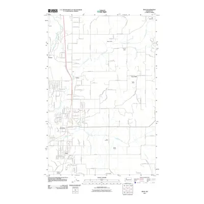
2011 Map of Mead
USGS Topo · Published 2011About this map
Peone Prairie and the surrounding tablelands north of Spokane are documented here in detail, showing a landscape defined by traditional agricultural settlements and modern infrastructure. The community of Colbert serves as a central point along the northern corridor, while Mead anchors the southern portion of the sheet near the Spokane Evergreen Cemetery. The map captures a mix of residential growth and long-standing landmarks, such as the Circle Bar J Boys Ranch and the Mead Flying Service Airport.
Find a feature on this map
129 named features on this map. Tap any name to fly to it.
Don’t see what you’re looking for? This feature index may not catch every label — zoom into the map to look around manually.
Map Details
Editions of this 2011 Mead Map
This is the sole edition of this map. No revisions or reprints were ever made.
Other maps of this area

1901 · Spokane
USGS Topo · 1:125,000

1943 · Mt Spokane
USGS Topo · 1:62,500

1949 · Deer Park
USGS Topo · 1:62,500

1949 · Greenacres
USGS Topo · 1:62,500

1950 · Spokane NE
USGS Topo · 1:24,000

1950 · Mt Spokane
USGS Topo · 1:62,500

1950 · Spokane NW
USGS Topo · 1:24,000

1950 · Spokane
USGS Topo · 1:62,500

1951 · Deer Park
USGS Topo · 1:62,500

1951 · Greenacres
USGS Topo · 1:62,500