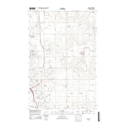
2014 Map of Mead
USGS Topo · Published 2014About this map
Mead and Colbert anchor this North Spokane landscape, where the transition from suburban expansion to high-plateau agriculture is clearly defined. The terrain is marked by distinctive geological features like Green Bluff and Orchard Bluff, which rise above the surrounding flats of Peone Prairie and Pleasant Prairie. These elevated benches have long supported the region's orchard and farming traditions, while the lowland corridors follow the path of Deadman Cr and the Little Spokane River.
Find a feature on this map
124 named features on this map. Tap any name to fly to it.
Don’t see what you’re looking for? This feature index may not catch every label — zoom into the map to look around manually.
Map Details
Editions of this 2014 Mead Map
This is the sole edition of this map. No revisions or reprints were ever made.
Other maps of this area

1901 · Spokane
USGS Topo · 1:125,000

1943 · Mt Spokane
USGS Topo · 1:62,500

1949 · Deer Park
USGS Topo · 1:62,500

1949 · Greenacres
USGS Topo · 1:62,500

1950 · Spokane NE
USGS Topo · 1:24,000

1950 · Mt Spokane
USGS Topo · 1:62,500

1950 · Spokane NW
USGS Topo · 1:24,000

1950 · Spokane
USGS Topo · 1:62,500

1951 · Deer Park
USGS Topo · 1:62,500

1951 · Greenacres
USGS Topo · 1:62,500