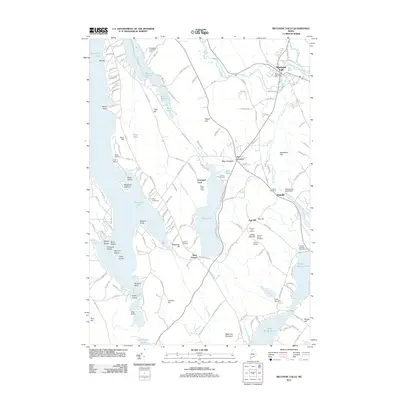
2011 Map of Mechanic Falls
USGS Topo · Published 2011About this map
Mechanic Falls sits at the junction of the Little Androscoggin River and Waterhouse Brook, a landscape defined by its historic water power and transition from village centers to rural highlands. The 2011 topography reveals a community structured around its water resources, including the Mechanic Falls Dam and the Waterhouse Brook Dam near Poland. This survey captures a mix of recreational and agricultural land use, with numerous camps like Camp Chittenden and Tripp Lake Camp lining the shores of Tripp Pond. Further west, the expansive Thompson Lake is dotted with landforms such as Megquier Island and Lunt Point, while the interior terrain rises toward Tiger Hill and Black Cat Mountain. Genealogists will find several burial grounds noted across the townships, including Locust Cemetery and Highland Cemetery, alongside landmarks such as the Summit Golf Course and the Poland Springs Campground.
Find a feature on this map
163 named features on this map. Tap any name to fly to it.
Don’t see what you’re looking for? This feature index may not catch every label — zoom into the map to look around manually.
Map Details
Editions of this 2011 Mechanic Falls Map
This is the sole edition of this map. No revisions or reprints were ever made.
Other maps of this area

1894 · Gray
USGS Topo · 1:62,500

1896 · Norway
USGS Topo · 1:62,500

1896 · Sebago
USGS Topo · 1:62,500

1898 · Gray
USGS Topo · 1:62,500

1908 · Poland
USGS Topo · 1:62,500

1940 · Poland
USGS Topo · 1:62,500

1942 · Poland
USGS Topo · 1:62,500

1942 · Gray
USGS Topo · 1:62,500

1942 · Sebago Lake
USGS Topo · 1:62,500

1943 · Sebago Lake
USGS Topo · 1:62,500