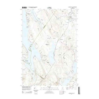
2014 Map of Mechanic Falls
USGS Topo · Published 2014About this map
Mechanic Falls sits at the northern edge of a landscape defined by an intricate network of waterways and glacial terrain, where the Little Androscoggin River flows near the village center. This 2014 survey captures a rural Maine topography where small settlements like Poland, West Poland, and the curiously named Promised Land are linked by local roads such as Bakerstown Rd and Poland Corner Rd. The area is characterized by prominent elevations like Pigeon Hill, Tiger Hill, and Black Cat Mountain, which overlook a chain of major water bodies including Thompson Lake, Tripp Pond, and the Upper, Middle, and Lower Range Pond.
Find a feature on this map
174 named features on this map. Tap any name to fly to it.
Don’t see what you’re looking for? This feature index may not catch every label — zoom into the map to look around manually.
Map Details
Editions of this 2014 Mechanic Falls Map
This is the sole edition of this map. No revisions or reprints were ever made.
Other maps of this area

1894 · Gray
USGS Topo · 1:62,500

1896 · Norway
USGS Topo · 1:62,500

1896 · Sebago
USGS Topo · 1:62,500

1898 · Gray
USGS Topo · 1:62,500

1908 · Poland
USGS Topo · 1:62,500

1940 · Poland
USGS Topo · 1:62,500

1942 · Poland
USGS Topo · 1:62,500

1942 · Gray
USGS Topo · 1:62,500

1942 · Sebago Lake
USGS Topo · 1:62,500

1943 · Sebago Lake
USGS Topo · 1:62,500