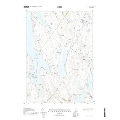
2021 Map of Mechanic Falls
USGS Topo · Published 2021About this map
Mechanic Falls and Poland anchor this 2021 landscape at the intersection of Androscoggin, Oxford, and Cumberland counties. The area is defined by its interconnected water systems, where the Little Androscoggin River winds through the northern settlements and the large expanses of Thompson Lake and Tripp Pond dominate the central and southern reaches. Small settlements like West Poland and the curiously named Promised Land appear alongside numerous family-named hills, including Pigeon Hill and Megquier Hill.
Find a feature on this map
162 named features on this map. Tap any name to fly to it.
Don’t see what you’re looking for? This feature index may not catch every label — zoom into the map to look around manually.
Map Details
Editions of this 2021 Mechanic Falls Map
This is the sole edition of this map. No revisions or reprints were ever made.
Other maps of this area

1894 · Gray
USGS Topo · 1:62,500

1896 · Norway
USGS Topo · 1:62,500

1896 · Sebago
USGS Topo · 1:62,500

1898 · Gray
USGS Topo · 1:62,500

1908 · Poland
USGS Topo · 1:62,500

1940 · Poland
USGS Topo · 1:62,500

1942 · Poland
USGS Topo · 1:62,500

1942 · Gray
USGS Topo · 1:62,500

1942 · Sebago Lake
USGS Topo · 1:62,500

1943 · Sebago Lake
USGS Topo · 1:62,500