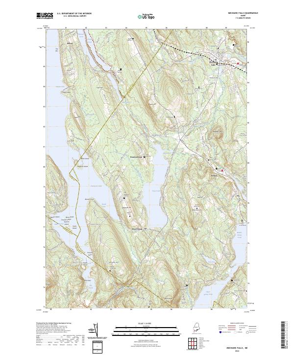
2024 Map of Mechanic Falls
USGS Topo · Published 2024About this map
Little Androscoggin River flows through the town of Mechanic Falls, anchoring a landscape of glacial lakes and family-named ridges on the border of Androscoggin and Oxford counties. This modern record reveals a settlement pattern deeply rooted in the past, where the lakefronts of Thompson Lake and Tripp Pond are interspersed with numerous private burial grounds. Genealogists will find an exceptional density of family-led markers, from the Amos Estes Family Cem in the south to the Old Megquier Hill Cem further north. The terrain transitions from the heights of Pigeon Hill and Tiger Hill down to wetlands like The Heath and Estes Bog. Small communities like West Poland and the curiously named Promised Land appear alongside more remote markers such as the Old Cem in the Woods, providing a precise look at the rural character of Maine's interior corridor.
Find a feature on this map
70 named features on this map. Tap any name to fly to it.
Don’t see what you’re looking for? This feature index may not catch every label — zoom into the map to look around manually.
Map Details
Editions of this 2024 Mechanic Falls Map
This is the sole edition of this map. No revisions or reprints were ever made.
Other maps of this area

1894 · Gray
USGS Topo · 1:62,500

1896 · Norway
USGS Topo · 1:62,500

1896 · Sebago
USGS Topo · 1:62,500

1898 · Gray
USGS Topo · 1:62,500

1908 · Poland
USGS Topo · 1:62,500

1940 · Poland
USGS Topo · 1:62,500

1942 · Poland
USGS Topo · 1:62,500

1942 · Gray
USGS Topo · 1:62,500

1942 · Sebago Lake
USGS Topo · 1:62,500

1943 · Sebago Lake
USGS Topo · 1:62,500